


توضیحات
The ultimate transit app: instantly compare all travel options in real-time across all transport modes!
Find alternative (more socially distanced) routes to safely navigate your city. Let our revamped GO assistant guide you turn-by-turn on all your transportation, walking, cycling, and scooter trips so you can enjoy the ride.
THOUSANDS OF 5 STAR REVIEWS
"This is my favorite transit app. Full-featured and a breeze to use. I really appreciate the Uber integration"
"Only way to get around NYC and Chicago. Easy and accurate. Download this one NOW"
"I love it. It’s the best thing since zippers, peanut and jelly and 1 TB thumb drives"
"Support for the SF Bay Area is particularly impressive because it aggregates all transit systems imaginable (BART, Caltrain, MUNI, VTA, etc.) into one seamless app"
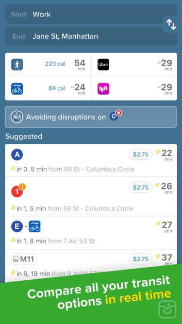
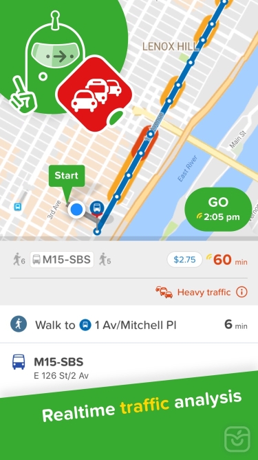
FIND THE BEST ROUTE ► Simple trip planning combining all transport modes: bus, subway, train, ferry, cabs, ride share, car share, bike share, e-scooters and walking. Discover routes you never knew existed
HIT THE GO BUTTON FOR STEP-BY-STEP DIRECTIONS ► Turn-by-turn navigation for all your transit, walking, personal cycling, bike shares and scooter trips. Choose between 3 different map views, see the charge levels of e-scooters and e-bikes around you, we even help you avoid no-parking zones. We take care of the logistical thinking so you are free to enjoy the ride
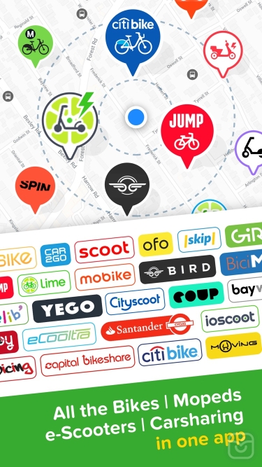
EXPERIENCE ONE-STOP-SHOP MOBILITY ► Compare cab fares, hail a ride, hop on a shared bike or find the nearest e-scooter all from within the app. Our partners include: Uber, Lyft, JUMP, Lime, Bird, Spin, Skip, Scoot, Citi Bike, JerseryBike, Bluebikes, Indego, CaBi, Divvy, Metro Bike, Breeze, Bay Wheels, Healthy Ride, Relay, BCycle, SA Bike Share, GREENbike, Grid, RTC Bike, BIKETOWN, Biki
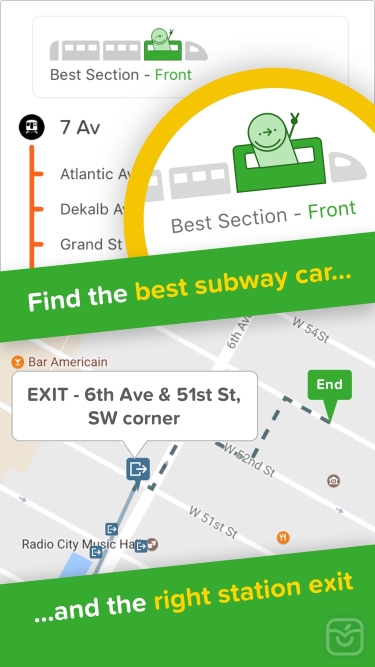
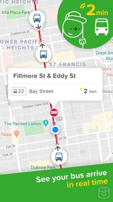
BEAT THE RUSH HOUR CROWD ► Live wait times and ETA so you'll never miss a bus, train or ferry again. Follow your bus / train as it's approaching on a real-time map, see the best train car to board, get alerted when it's time to get off, and get in and out from the best exit at any subway / train station
PERSONALIZE YOUR CITY ► Save Home, Work and your go-to stops or stations for lightning fast trip planning. Subscribe to your favorite subway, train, bus or ferry line for automatic disruption, delay, and status alerts
GET SOCIAL ► Share your live trip: let friends follow your live trip to know when you'll arrive. Share any location or address: one tap for others to get directions
TRAVEL OFFLINE ► Access offline the official NYC subway map, Manhattan bus map, Brooklyn bus map, Queens bus map, DC metro map, Muni Metro map, and more
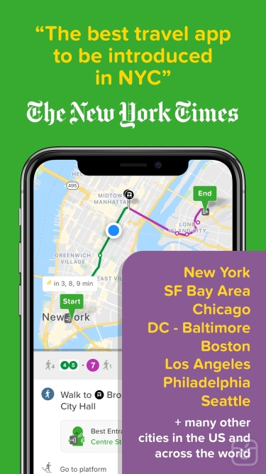
CITY COVERAGE ► New York City | Chicago | Los Angeles | San Francisco | Washington DC | Boston | Philadelphia | Seattle | Miami | Atlanta | Portland | Denver | Baltimore | San Diego | Minneapolis | Houston | Phoenix | Dallas | Las Vegas | Pittsburgh | Honolulu | Salt Lake City | San Antonio | St. Louis | Cleveland | Austin
- Many more worldwide! See the full list and vote for the next one in the app or at https://citymapper.com/cities
TRANSIT AGENCIES ► We use open data from transit agencies in the cities we cover, including: MTA | CTA | LA Metro | MBTA | WMATA | SEPTA | NJ Transit | Muni | BART | King Bus | MARTA | LIRR | RTD | TriMet | Metro-North Railroad | PATH | Houston METRO | San Diego MTS | Miami-Dade Transit | Metro Transit | METRA | RTC Bus | TheBus | Port Authority | DART | AC Transit | Sound Transit | UTA | OCTA | VIA | PTD | Metro Transit | RTA | Capital Metro | Broward County Transit Division | NY Waterway Ferries | Washington State Ferries | LBT | Nassau Inter County Express (NICE)| Valley Metro | Metrolink | Santa Monica Big Blue Bus (BBB)
KEEP IN TOUCH ► If you have questions or feedback or something we may have missed in your city email us at support@citymapper.com
Like us on Facebook: http://facebook.com/thecitymapper
Follow us on Twitter: http://twitter.com/Citymapper
Visit our website: http://citymapper.com
تغییرات نسخه اخیر
- Support for iOS 14
Widgets are coming to your home screen
Improvements to turn by turn navigation for cycling and scooters
توسعه دهنده
Citymapper Limited